
Carte topographique Warmfield
Cliquez sur la carte pour afficher l’altitude.
À propos de cette carte
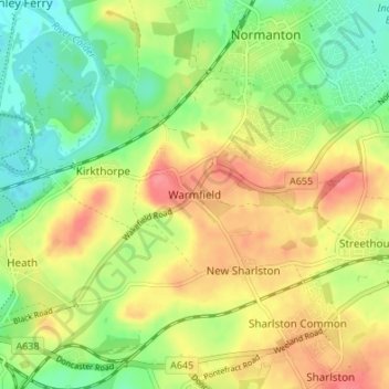
Nom : Carte topographique Warmfield, altitude, relief.
Altitude moyenne : 47 m
Altitude minimum : 15 m
Altitude maximum : 81 m
Autres cartes topographiques
Cliquez sur une carte pour visualiser sa topographie, son altitude et son relief.
Hemsworth Water Park
United Kingdom > England > Wakefield > Hemsworth > Kinsley
Altitude moyenne : 60 m
Ackworth
United Kingdom > England > Wakefield
Quarrying was also important around the areas of Moor Top and Brackenhill. There was a long tradition of quarrying and masonry, and the production of building stone and high-quality grindstones used in agriculture and tool-making. Saywell (1894) describes Brackenhill as "almost entirely inhabited by…
Altitude moyenne : 45 m
Featherstone Colliery
United Kingdom > England > Wakefield > Featherstone > Snydale
Altitude moyenne : 44 m