
Carte topographique Kowloon City District
Carte interactive
Cliquez sur la carte pour afficher l’altitude.
À propos de cette carte
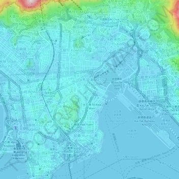
Nom : Carte topographique Kowloon City District, altitude, relief.
Lieu : Kowloon City District, Kowloon, Hong Kong, China (22.29411 114.17273 22.34933 114.21938)
Altitude moyenne : 37 m
Altitude minimum : -31 m
Altitude maximum : 438 m
Autres cartes topographiques
Cliquez sur une carte pour visualiser sa topographie, son altitude et son relief.