
Carte topographique Chappell Hill
Carte interactive
Cliquez sur la carte pour afficher l’altitude.
À propos de cette carte
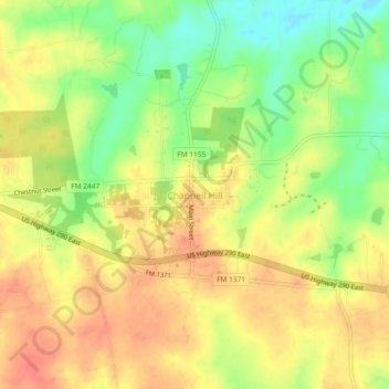
Nom : Carte topographique Chappell Hill, altitude, relief.
Altitude moyenne : 83 m
Altitude minimum : 53 m
Altitude maximum : 104 m
Autres cartes topographiques
Cliquez sur une carte pour visualiser sa topographie, son altitude et son relief.
Brenham
United States > Texas > Washington County
Brenham, Washington County, Texas, United States
Altitude moyenne : 98 m
Independence
United States > Texas > Washington County > Independence
Independence, Washington County, Texas, United States
Altitude moyenne : 106 m
Burton
United States > Texas > Washington County
Burton, Washington County, Texas, United States
Altitude moyenne : 132 m