
Faire un don
Équipez-vous pour votre prochaine aventure :
En tant que Partenaire Amazon, ce site perçoit une commission sur les achats éligibles sans surcoût pour vous.
Carte topographique Acornhoek
Cliquez sur la carte pour afficher l’altitude.
Faire un don
Équipez-vous pour votre prochaine aventure :
En tant que Partenaire Amazon, ce site perçoit une commission sur les achats éligibles sans surcoût pour vous.
À propos de cette carte
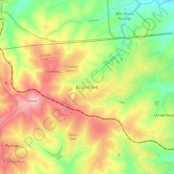
Nom : Carte topographique Acornhoek, altitude, relief.
Altitude moyenne : 629 m
Altitude minimum : 538 m
Altitude maximum : 724 m
Faire un don
Équipez-vous pour votre prochaine aventure :
En tant que Partenaire Amazon, ce site perçoit une commission sur les achats éligibles sans surcoût pour vous.
Autres cartes topographiques
Cliquez sur une carte pour visualiser sa topographie, son altitude et son relief.
Witklip Dam
South Africa > Mpumalanga > Ehlanzeni District Municipality > Thaba Chweu Local Municipality
Altitude moyenne : 1 048 m
Manyeleti
South Africa > Mpumalanga > Ehlanzeni District Municipality > Bushbuckridge
Altitude moyenne : 376 m
Thaba Chweu Local Municipality
South Africa > Mpumalanga > Ehlanzeni District Municipality
Altitude moyenne : 1 207 m
Faire un don
Équipez-vous pour votre prochaine aventure :
En tant que Partenaire Amazon, ce site perçoit une commission sur les achats éligibles sans surcoût pour vous.
Umjindi Ward 1
South Africa > Mpumalanga > Ehlanzeni District Municipality > Umjindi Local Municipality
Altitude moyenne : 916 m
Tekwane North
South Africa > Mpumalanga > Ehlanzeni District Municipality > Mbombela > eMankayana
Altitude moyenne : 771 m
Faire un don
Équipez-vous pour votre prochaine aventure :
En tant que Partenaire Amazon, ce site perçoit une commission sur les achats éligibles sans surcoût pour vous.
Blyde River
South Africa > Mpumalanga > Ehlanzeni District Municipality
The Motlatse River ("Permanent River"), Blyde River (Afrikaans: Blyderivier "Glad River"), or Umdhlazi River is a river in the Mpumalanga and Limpopo provinces of South Africa. It has a northwards course in steep-sided valleys and ravines of the Mpumalanga Drakensberg, before it enters the lowveld region of…
Altitude moyenne : 930 m
Driekoppies Dam
South Africa > Mpumalanga > Ehlanzeni District Municipality > Nkomazi > Schulzendal
Altitude moyenne : 355 m
Lydenburg
South Africa > Mpumalanga > Ehlanzeni District Municipality > Thaba Chweu Local Municipality
Altitude moyenne : 1 424 m
Faire un don
Équipez-vous pour votre prochaine aventure :
En tant que Partenaire Amazon, ce site perçoit une commission sur les achats éligibles sans surcoût pour vous.
Kwena Dam
South Africa > Mpumalanga > Ehlanzeni District Municipality > Thaba Chweu Local Municipality
Altitude moyenne : 1 185 m
Umjindi Local Municipality
South Africa > Mpumalanga > Ehlanzeni District Municipality
Altitude moyenne : 1 007 m
Lydenburg
South Africa > Mpumalanga > Ehlanzeni District Municipality > Thaba Chweu Local Municipality
Altitude moyenne : 1 424 m
Kwena Dam
South Africa > Mpumalanga > Ehlanzeni District Municipality > Thaba Chweu Local Municipality
Altitude moyenne : 1 185 m
Faire un don
Équipez-vous pour votre prochaine aventure :
En tant que Partenaire Amazon, ce site perçoit une commission sur les achats éligibles sans surcoût pour vous.
Thaba Chweu Local Municipality
South Africa > Mpumalanga > Ehlanzeni District Municipality
Altitude moyenne : 1 207 m
Longmere Dam
South Africa > Mpumalanga > Ehlanzeni District Municipality > Mbombela > White River Country Estates
Altitude moyenne : 963 m
Umbabat Nature Reserve
South Africa > Mpumalanga > Ehlanzeni District Municipality > Bushbuckridge
Altitude moyenne : 343 m
Manyeleti
South Africa > Mpumalanga > Ehlanzeni District Municipality > Bushbuckridge
Altitude moyenne : 376 m
Faire un don
Équipez-vous pour votre prochaine aventure :
En tant que Partenaire Amazon, ce site perçoit une commission sur les achats éligibles sans surcoût pour vous.
MalaMala Game Reserve
South Africa > Mpumalanga > Ehlanzeni District Municipality > Bushbuckridge
Altitude moyenne : 338 m
Marite
South Africa > Mpumalanga > Ehlanzeni District Municipality > Bushbuckridge
Altitude moyenne : 602 m
MalaMala Game Reserve
South Africa > Mpumalanga > Ehlanzeni District Municipality > Bushbuckridge
Altitude moyenne : 338 m
Faire un don
Équipez-vous pour votre prochaine aventure :
En tant que Partenaire Amazon, ce site perçoit une commission sur les achats éligibles sans surcoût pour vous.
Thaba Chweu Local Municipality
South Africa > Mpumalanga > Ehlanzeni District Municipality
Altitude moyenne : 1 207 m
Blyde River Canyon Nature Reserve
South Africa > Mpumalanga > Ehlanzeni District Municipality > Thaba Chweu Local Municipality
The Mogologolo (1,794 m), Mariepskop (1,944 m) and Hebronberg (1,767 m) massifs are partially included in the reserve. Elevation varies from 560 m to 1,944 m above sea level. Its resort areas are F.H. Odendaal and Swadeni, the latter only accessible from Limpopo province. The area of approximately 29,000…
Altitude moyenne : 1 040 m
Klipkoppie Dam
South Africa > Mpumalanga > Ehlanzeni District Municipality > Mbombela
Altitude moyenne : 973 m
Faire un don
Équipez-vous pour votre prochaine aventure :
En tant que Partenaire Amazon, ce site perçoit une commission sur les achats éligibles sans surcoût pour vous.
Klaserie Private Nature Reserve
South Africa > Mpumalanga > Ehlanzeni District Municipality
Altitude moyenne : 395 m
Thaba Chweu Local Municipality
South Africa > Mpumalanga > Ehlanzeni District Municipality
Altitude moyenne : 1 207 m