
Carte topographique Eyjafjallajökull
Carte interactive
Cliquez sur la carte pour afficher l’altitude.
À propos de cette carte
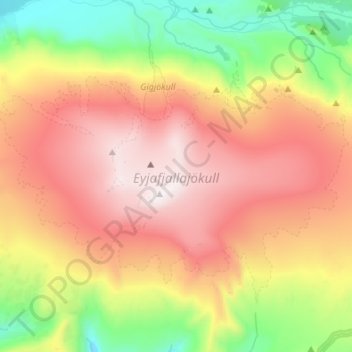
Nom : Carte topographique Eyjafjallajökull, altitude, relief.
Altitude moyenne : 821 m
Altitude minimum : 109 m
Altitude maximum : 1 628 m
Eyjafjallajökull (Icelandic: (listen); lit. 'glacier of the mountains of the islands') is one of the smaller ice caps of Iceland, north of Skógar and west of Mýrdalsjökull. The ice cap covers the caldera of a volcano with a summit elevation of 1,651 metres (5,417 ft). The volcano has erupted relatively frequently since the Last Glacial Period, most recently in 2010, when, although relatively small for a volcanic eruption, it caused enormous disruption to air travel across western and northern Europe for a week.
Autres cartes topographiques
Cliquez sur une carte pour visualiser sa topographie, son altitude et son relief.
Eyjafjallajökull
Eyjafjallajökull, Rangárþing eystra, Southern Region, Iceland
Altitude moyenne : 1 459 m
Skogafoss
Skogafoss, Rangárþing eystra, Southern Region, Iceland
Altitude moyenne : 145 m