
Carte topographique Port Neill
Cliquez sur la carte pour afficher l’altitude.
Port Neill
Matthew Flinders sailed past on 7 March 1802 and reported 'low front land, somewhat sandy, with raised land inland and of a barren appearance, its elevation diminishing to the northward.' The first land-based European exploration took place in April 1840, when the party of Governor Gawler, John Hill, and Thomas Burr explored the Spencer Gulf coast on horseback, they being the first Europeans to traverse the landward regions of this coast between Port Lincoln and the Middleback Ranges near Whyalla. They roughly followed the route of the present Lincoln Highway. During this expedition Gawler named Cape Burr as well as nearby Mount Hill.
À propos de cette carte
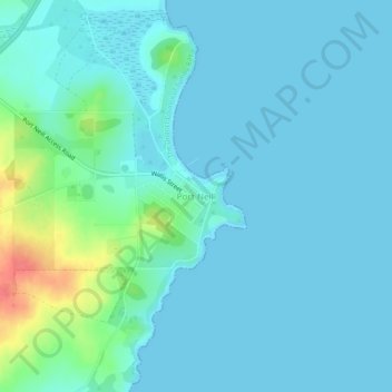
Nom : Carte topographique Port Neill, altitude, relief.
Altitude moyenne : 9 m
Altitude minimum : 0 m
Altitude maximum : 58 m
Autres cartes topographiques
Cliquez sur une carte pour visualiser sa topographie, son altitude et son relief.
Eden Valley
Eden Valley is a small South Australian town in the Barossa Ranges. It was named by the surveyors of the area after they found the word "Eden" carved into a tree. Eden Valley has an elevation of 460 metres and an average annual rainfall of 716.2mm. Eden Valley is in the Barossa Council local government area,…
Altitude moyenne : 369 m
Mount Barker
Mount Barker is located on the plains surrounding the Mount Barker Summit, about 2 km west of the mountain itself, at 35°04′S 138°51′E / 35.067°S 138.850°E / -35.067; 138.850. Mount Barker is south east of Mount Lofty and Adelaide. It is to the north of The Coorong, and the west of Murray…
Altitude moyenne : 368 m
Gumeracha
Gumeracha is also home to Applewood Distillery, Australia's highest altitude distillery, specialising in Gin and Amaro showcasing native Australian botanicals like finger limes and strawberry gum.
Altitude moyenne : 408 m
Williamstown
Williamstown has an elevation of 310 m and an average rainfall of 680 mm. It has a summer average temperature of 31 °C with temperatures often reaching the mid 40s, and a winter average temperature of 15 °C, with nights dropping below freezing, which makes the region excellent for the cultivation of fruits,…
Altitude moyenne : 310 m
Lyndoch
Lyndoch is a town in Barossa Valley, located on the Barossa Valley Highway between Gawler and Tanunda, 58 km northeast of Adelaide. The town has an elevation of 175m and an average rainfall of 560.5mm. It is one of the oldest towns in South Australia.
Altitude moyenne : 216 m
Inman Valley
In the valley is Selwyn Rock (35°29′47″S 138°30′45″E / 35.4965°S 138.5124°E / -35.4965; 138.5124) a glaciated pavement in the bed of the Inman River. It was first described in 1859 by, and later named for, A.R.C. Selwyn,[17] who was Victorian Government geologist at the time. Glacial…
Altitude moyenne : 212 m
Stirling
Many deciduous trees, particularly the maple, elm, oak and ash trees, have been imported from Europe and North America. These trees flourish in Stirling's wet and mild to cool climate and are a popular tourist attraction in the autumn months (April–May), bringing rich and vibrant autumn leaf colour to the…
Altitude moyenne : 504 m