Géolocaliser

Carte topographique Tweed Heads

Cliquez sur la carte pour afficher l’altitude.

À propos de cette carte

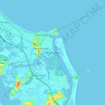
Nom : Carte topographique Tweed Heads, altitude, relief.

Lieu : Tweed Heads, Tweed Shire Council, New South Wales, 2485, Australia (-28.22171 153.50696 -28.14171 153.58696)

Altitude moyenne : 3 m

Altitude minimum : -3 m

Altitude maximum : 74 m

Autres cartes topographiques

Cliquez sur une carte pour visualiser sa topographie, son altitude et son relief.

Sydney

Australia > New South Wales

Sydney's topography is characterized by a diverse landscape that seamlessly blends coastal features with inland plateaus. The city is divided into two primary regions: the relatively flat Cumberland Plain to the south and west of Sydney Harbour, and the elevated Hornsby Plateau to the north. The Cumberland…

Altitude moyenne : 53 m

Newcastle

Australia > New South Wales

Altitude moyenne : 5 m

Taree

Australia > New South Wales

Altitude moyenne : 17 m

Wingham

Australia > New South Wales

Altitude moyenne : 47 m

Mudgee

Australia > New South Wales

Altitude moyenne : 535 m

Botany

Australia > New South Wales > Sydney

Altitude moyenne : 6 m

Botany Bay

Australia > New South Wales > Sydney

Altitude moyenne : 8 m

Epping

Australia > New South Wales

Altitude moyenne : 96 m

Manly Dam

Australia > New South Wales > Sydney

Altitude moyenne : 51 m

Penrith

Australia > New South Wales > Sydney > Penrith

Penrith is a city in New South Wales, Australia, located in Greater Western Sydney, 55 kilometres (31 mi) west of the Sydney central business district on the banks of the Nepean River, on the outskirts of the Cumberland Plain. Its elevation is 32 metres (105 ft).

Altitude moyenne : 34 m

Baulkham Hills

Australia > New South Wales

Altitude moyenne : 93 m

Manly Vale

Australia > New South Wales > Sydney

Altitude moyenne : 34 m

Nymboida

Australia > New South Wales

Altitude moyenne : 280 m

Borenore

Australia > New South Wales

Altitude moyenne : 748 m

Mount Victoria

Australia > New South Wales

Mount Victoria (postcode: 2786) is a small township in the Blue Mountains of New South Wales, Australia. Mount Victoria is geographically the western most village and suburb of Greater Sydney on the great western highway in the City of Blue Mountains, located about 120 kilometres (75 mi) west-northwest by road…

Altitude moyenne : 901 m

Tyalgum

Australia > New South Wales

Altitude moyenne : 161 m

Sydney

Australia > New South Wales > Sydney

Altitude moyenne : 23 m

Lake Macquarie

Australia > New South Wales > Silverwater

Altitude moyenne : 20 m

Blue Mountains

Australia > New South Wales

A sandstone plateau dominated by a landscape of endless eucalyptus forests, the Blue Mountains are located at the top of a 470-million-year-old quartzite. In the Permian period, a shallow sea covered the region, when rivers brought shales, siltstones and mudstones. Then during the Mesozoic period, rivers…

Altitude moyenne : 566 m

Dalgety

Australia > New South Wales

Altitude moyenne : 866 m

Tahmoor

Australia > New South Wales

Altitude moyenne : 269 m

Camden Council

Australia > New South Wales

Altitude moyenne : 90 m

Ashfield

Australia > New South Wales > Sydney

Altitude moyenne : 26 m

Nimbin

Australia > New South Wales

Altitude moyenne : 235 m

West Pennant Hills

Australia > New South Wales

Altitude moyenne : 130 m

Castle Hill

Australia > New South Wales > Sydney

Altitude moyenne : 123 m

Kangaroo Valley

Australia > New South Wales

Altitude moyenne : 320 m

Wellington

Australia > New South Wales

Altitude moyenne : 321 m

Iluka

Australia > New South Wales

Altitude moyenne : 2 m

Mullion Creek

Australia > New South Wales

Altitude moyenne : 767 m

Picton

Australia > New South Wales

Altitude moyenne : 227 m

Armidale

Australia > New South Wales

Altitude moyenne : 1 036 m

Byron Bay

Australia > New South Wales

Byron Bay, located in northeastern New South Wales, Australia, is characterized by diverse topography shaped by its geological history. The town is part of the erosion caldera of the ancient Tweed Volcano, which erupted approximately 23 million years ago, resulting in the rich volcanic soils that define the…

Altitude moyenne : 7 m

Port Kembla

Australia > New South Wales

Altitude moyenne : 10 m

Woolgoolga

Australia > New South Wales

Altitude moyenne : 29 m

Medlow Bath

Australia > New South Wales

Medlow Bath (postcode: 2780) is an Australian small town located near the highest point of the Blue Mountains, between Katoomba and Blackheath. Its altitude is about 1,050 metres (3,440 ft) AHD  and it is about 115 kilometres (71 mi) west-north-west of the Sydney central business district and 5 kilometres…

Altitude moyenne : 930 m

Dungog Shire Council

Australia > New South Wales

Altitude moyenne : 272 m

Tweed Shire Council

Australia > New South Wales

Altitude moyenne : 212 m

Raymond Terrace

Australia > New South Wales

Altitude moyenne : 9 m

Bonnells Bay

Australia > New South Wales

Altitude moyenne : 9 m

Nowra Hill

Australia > New South Wales

Altitude moyenne : 84 m

Kellyville

Australia > New South Wales

Altitude moyenne : 70 m

Yerrinbool

Australia > New South Wales

Altitude moyenne : 468 m

Budawang Range

Australia > New South Wales

The highest mountain in the range is Mount Budawang that has an elevation of 1,129 metres (3,704 ft) above sea level.

Altitude moyenne : 484 m

Grose Valley

Australia > New South Wales > Blackheath

The bulk of the vegetation in the wilderness is dry open forest and woodland, dominated by Eucalyptus sieberi and E. piperita above 800 metres (2,600 ft) altitude with Eucalyptus oblonga, E. globoidea, E. agglomerata and Angophora costata becoming dominant at lower altitudes. Plateau areas have thinner or…

Altitude moyenne : 833 m

Batlow

Australia > New South Wales

Altitude moyenne : 803 m

The Channon

Australia > New South Wales

Altitude moyenne : 105 m

Darlinghurst

Australia > New South Wales > Sydney

Altitude moyenne : 38 m

Oatley

Australia > New South Wales > Sydney

Altitude moyenne : 24 m

Marrickville

Australia > New South Wales > Sydney

Altitude moyenne : 17 m

Lower North Shore

Australia > New South Wales > Sydney

Altitude moyenne : 45 m

St Leonards Park

Australia > New South Wales > Sydney > North Sydney

In 2018 it was announced that North Sydney Council would commence an upgrade of the park including improving the war memorial with a reflection pool, restoration of the Tunks Fountain and elevation on a new plinth, new benches, picnic tables, barbecues and drinking fountains, upgrades to lighting, additional…

Altitude moyenne : 61 m

Wolumla

Australia > New South Wales

Altitude moyenne : 147 m

Carlingford

Australia > New South Wales > Sydney

Altitude moyenne : 98 m

Katoomba

Australia > New South Wales

Altitude moyenne : 904 m

Leichhardt

Australia > New South Wales > Sydney

Altitude moyenne : 22 m

Bronte

Australia > New South Wales > Sydney

Altitude moyenne : 42 m

Winmalee

Australia > New South Wales

Altitude moyenne : 270 m

Eden

Australia > New South Wales

Altitude moyenne : 55 m

Dural

Australia > New South Wales > Sydney

Altitude moyenne : 157 m

Marsden Park

Australia > New South Wales > Sydney

Altitude moyenne : 31 m

Wauchope

Australia > New South Wales

Altitude moyenne : 32 m

Crookwell

Australia > New South Wales

Crookwell is a small town located in the Southern Tablelands of New South Wales, Australia, in the Upper Lachlan Shire. At the 2016 census, Crookwell had a population of 2,641. The town is at a relatively high altitude of 887 metres and there are several snowfalls during the winter months. The nearest major…

Altitude moyenne : 904 m

Werrington

Australia > New South Wales > Sydney

Altitude moyenne : 30 m

Gibraltar Range

Australia > New South Wales

Altitude moyenne : 686 m

Cooranbong

Australia > New South Wales

Altitude moyenne : 72 m

Barrington Tops

Australia > New South Wales

Altitude moyenne : 1 107 m

Bowral

Australia > New South Wales

Altitude moyenne : 690 m

Yass

Australia > New South Wales

Yass is located 280 km south-west of Sydney, on the Hume Highway. The Yass River, which is a tributary of the Murrumbidgee River, flows through the town. Yass is 59 km from Canberra; lying at an elevation of 505 m AMSL.

Altitude moyenne : 533 m

Goulburn

Australia > New South Wales

Owing to its elevation, Goulburn has an oceanic climate (Cfb) with warm summers and cool winters; with a high diurnal range. Its climate is variable much of the year, though generally dry with maximum temperatures ranging from 11.8 °C (53.2 °F) in July to 28.3 °C (82.9 °F) in January. Rainfall is…

Altitude moyenne : 666 m

Nowra

Australia > New South Wales

Altitude moyenne : 21 m

Avoca Beach

Australia > New South Wales

Altitude moyenne : 23 m

Leppington

Australia > New South Wales

Altitude moyenne : 89 m

Balgowlah

Australia > New South Wales > Sydney

Altitude moyenne : 40 m

North Epping

Australia > New South Wales

Altitude moyenne : 84 m

Corowa

Australia > New South Wales

Altitude moyenne : 144 m

Minnamurra River

Australia > New South Wales

Altitude moyenne : 8 m

Kiama

Australia > New South Wales

Altitude moyenne : 29 m

Bilgola Plateau

Australia > New South Wales

The suburb is mainly residential, with two small rows of shops, a small park and a primary school located on the top of the plateau. Bilgola Beach on the eastern side features a surf club and kiosk. Rising to an elevation of 150m above sea level, the suburb has views of the beach and the ocean on the eastern…

Altitude moyenne : 37 m

Woodenbong

Australia > New South Wales

Altitude moyenne : 474 m

Dirty Creek

Australia > New South Wales

Altitude moyenne : 77 m

Shellharbour

Australia > New South Wales

Altitude moyenne : 9 m

Orange

Australia > New South Wales

Orange is a city in the Central Tablelands region of New South Wales, Australia. It is 254 km (158 mi) west of the state capital, Sydney [206 km (128 mi) on a great circle], at an altitude of 862 metres (2,828 ft). Orange had an estimated urban population of 40,493 as of June 2018 making the city a significant…

Altitude moyenne : 852 m

Lismore

Australia > New South Wales

Altitude moyenne : 23 m

Dubbo

Australia > New South Wales

Altitude moyenne : 318 m

Warialda

Australia > New South Wales

Altitude moyenne : 420 m

Cassilis

Australia > New South Wales

Altitude moyenne : 560 m

Équipez-vous pour votre prochaine aventure :

🎩Bonnet Technique - Protégez vos oreilles du vent sur les crêtes.
🛑Sifflets de survie - Accessoires de signalisation sonore
🗺️Atlas géographiques - Ouvrages cartographiques détaillés
📏Podomètre de Précision - Mesurez vos distances parcourues sur les sentiers luxembourgeois.
🔦Lampes frontales - Éclairage mains libres pour marche nocturne et bivouac

En tant que Partenaire Amazon, ce site perçoit une commission sur les achats éligibles sans surcoût pour vous.