
Carte topographique Yotei Zan
Carte interactive
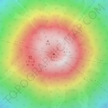
Cliquez sur la carte pour afficher l’altitude.
À propos de cette carte
Nom : Carte topographique Yotei Zan, altitude, relief.
Altitude moyenne : 1 372 m
Altitude minimum : 748 m
Altitude maximum : 1 881 m
In the 50,000:1 scale topographical map of the “Rusutsu” area published in 1920 by Japan’s Land Surveying Department, the mountain is recorded as "Shiribeshi-Yōtei-zan (Ezo-Fuji)". However, since the name was difficult to read, the town of Kutchan asked for it to be changed to Yōtei-zan. The change took place in the November 1969 topographical map published by the Geospatial Information Authority of Japan. Since then, the current name of Yōtei-zan has become established.