
Carte topographique Horst
Carte interactive
Cliquez sur la carte pour afficher l’altitude.
À propos de cette carte
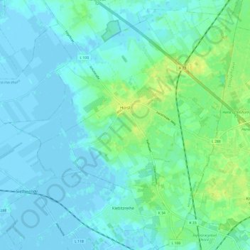
Nom : Carte topographique Horst, altitude, relief.
Altitude moyenne : 5 m
Altitude minimum : -3 m
Altitude maximum : 18 m
Autres cartes topographiques
Cliquez sur une carte pour visualiser sa topographie, son altitude et son relief.
Oldendorf
Duitsland > Sleeswijk-Holstein > Kreis Steinburg
Oldendorf, Amt Itzehoe-Land, Kreis Steinburg, Sleeswijk-Holstein, 25588, Duitsland
Altitude moyenne : 10 m