Géolocaliser

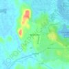
Carte topographique Limerick

Cliquez sur la carte pour afficher l’altitude.

Limerick

Limerick's climate is classified as temperate oceanic (Köppen Cfb). Met Éireann maintains a climatological weather station at Shannon Airport, 20 kilometres west of the city in County Clare. Shannon Airport records an average of 977 millimetres of precipitation annually, most of which is rain. Limerick has a mild climate, with the average daily maximum in July of 20 °C (68 °F) and the average daily minimum in January of 3 °C (37 °F). The highest temperature recorded was 32.0 °C (89.6 °F) in June 2018, and the lowest −11.4 °C (11.5 °F) in 2010. Limerick is the cloudiest city in the country, averaging only 1,295 sunshine hours annually, 3.5 hours of sunshine every day. There are on average 62 days of no recordable sunshine, 6 days of thunder, 22 days of hail and 11 days of snow per year. Shannon Airport is located by the ocean at an elevation of 14 metres, so snow is less common at the station than in the city itself.

À propos de cette carte

Nom : Carte topographique Limerick, altitude, relief.

Lieu : Limerick, The Metropolitan District of Limerick City, County Limerick, Munster, Ireland (52.64809 -8.70566 52.68889 -8.60187)

Altitude moyenne : 10 m

Altitude minimum : -4 m

Altitude maximum : 41 m

Autres cartes topographiques

Cliquez sur une carte pour visualiser sa topographie, son altitude et son relief.

Coolreiry

Ireland > County Limerick > Limerick > Daly's Cross

Altitude moyenne : 35 m

Ballybrown

Ireland > County Limerick > Limerick

Altitude moyenne : 9 m

Ballyvarra

Ireland > County Limerick > Limerick

Altitude moyenne : 30 m

Clonmacken

Ireland > County Limerick > Limerick

Altitude moyenne : 5 m

Coonagh West

Ireland > County Limerick > Limerick

Altitude moyenne : 2 m

Towlerton

Ireland > County Limerick > Limerick

Altitude moyenne : 20 m

Cloghatacka

Ireland > County Limerick > Limerick

Altitude moyenne : 7 m

Rivers

Ireland > County Limerick > Limerick

Altitude moyenne : 34 m

Rivers

Ireland > County Limerick > Limerick

Altitude moyenne : 19 m

Ballycummin

Ireland > County Limerick > Limerick

Altitude moyenne : 16 m

Mungret

Ireland > County Limerick > Limerick

Altitude moyenne : 10 m

Stradbally North

Ireland > County Limerick > Limerick

Altitude moyenne : 33 m

Patrickswell

Ireland > County Limerick > Limerick

Altitude moyenne : 22 m

Ahane

Ireland > County Limerick > Limerick

Altitude moyenne : 31 m

Loughmore Common

Ireland > County Limerick > Limerick

Altitude moyenne : 14 m

Courtbrack

Ireland > County Limerick > Limerick

Altitude moyenne : 7 m

Ballykeeffe

Ireland > County Limerick > Limerick

Altitude moyenne : 6 m

Coolishal

Ireland > County Limerick > Limerick

Altitude moyenne : 33 m

Market

Ireland > County Limerick > Limerick

Altitude moyenne : 12 m

Lisnagry

Ireland > County Limerick > Limerick > Old Garden

Altitude moyenne : 27 m

Rich Hill

Ireland > County Limerick > Limerick > Ahane

Altitude moyenne : 31 m

Mungret

Ireland > County Limerick > Limerick

Altitude moyenne : 10 m

Équipez-vous pour votre prochaine aventure :

🧺Couverture de Sol - Base isolante pour vos pauses déjeuner en pleine nature.
📸Trépied de Voyage - Stabilité pour vos photos de paysages topographiques.
🧥Veste de Pluie (Hardshell) - Protection contre les intempéries pour rester au sec sur le terrain.
🧴Gel Hydroalcoolique - Hygiène des mains rapide avant de manger sur le pouce.
⛸️Crampons de Chaussures - Sécurité antidérapante sur les sentiers verglacés.

En tant que Partenaire Amazon, ce site perçoit une commission sur les achats éligibles sans surcoût pour vous.