
Carte topographique Skútustaðahreppur
Carte interactive
Cliquez sur la carte pour afficher l’altitude.
À propos de cette carte
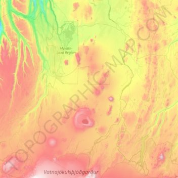
Nom : Carte topographique Skútustaðahreppur, altitude, relief.
Lieu : Skútustaðahreppur, Northeastern Region, 660, Iceland (64.66128 -17.33507 65.80888 -16.00546)
Altitude moyenne : 661 m
Altitude minimum : -1 m
Altitude maximum : 1 903 m
Autres cartes topographiques
Cliquez sur une carte pour visualiser sa topographie, son altitude et son relief.
Hverfjall Crater
Hverfjall Crater, Skútustaðahreppur, Northeastern Region, 660, Iceland
Altitude moyenne : 330 m
Krafla
Krafla, Skútustaðahreppur, Northeastern Region, Iceland
Altitude moyenne : 622 m