
Carte topographique Leyfields
Carte interactive
Cliquez sur la carte pour afficher l’altitude.
À propos de cette carte
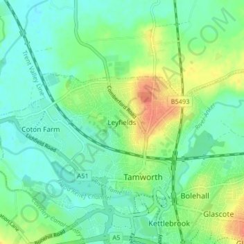
Nom : Carte topographique Leyfields, altitude, relief.
Altitude moyenne : 66 m
Altitude minimum : 52 m
Altitude maximum : 92 m
Autres cartes topographiques
Cliquez sur une carte pour visualiser sa topographie, son altitude et son relief.
Coton Farm
United Kingdom > England > Staffordshire > Tamworth
Coton Farm, Tamworth, Staffordshire, England, B79 7TZ, United Kingdom
Altitude moyenne : 72 m
Tamworth Castle
United Kingdom > England > Staffordshire > Tamworth > Leyfields
Tamworth Castle, Market Street, Bolehall, Leyfields, Tamworth, Staffordshire, England, B79 7LD, United Kingdom
Altitude moyenne : 65 m