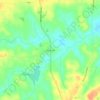
Carte topographique Warm Springs
Cliquez sur la carte pour afficher l’altitude.
Warm Springs
Warm Springs is located in southern Meriwether County at 32°53′19″N 84°40′48″W / 32.88861°N 84.68000°W / 32.88861; -84.68000 (32.888689, −84.680089). It is bordered to the south by Talbot County and to the west by F. D. Roosevelt State Park, including the Little White House. Pine Mountain rises to an elevation of 1,340 feet (410 m) south of the city, about 400 feet (120 m) higher than the city center.
À propos de cette carte

Nom : Carte topographique Warm Springs, altitude, relief.
Lieu : Warm Springs, Meriwether County, Georgia, United States (32.86937 -84.68550 32.90197 -84.66666)
Altitude moyenne : 295 m
Altitude minimum : 241 m
Altitude maximum : 386 m
Autres cartes topographiques
Cliquez sur une carte pour visualiser sa topographie, son altitude et son relief.