
Carte topographique Maisach
Cliquez sur la carte pour afficher l’altitude.
À propos de cette carte
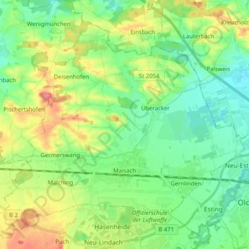
Nom : Carte topographique Maisach, altitude, relief.
Altitude moyenne : 520 m
Altitude minimum : 493 m
Altitude maximum : 573 m
Autres cartes topographiques
Cliquez sur une carte pour visualiser sa topographie, son altitude et son relief.
Pleitmannswang
Deutschland > Bayern > Landkreis Fürstenfeldbruck > Türkenfeld
Altitude moyenne : 568 m
Weiherhaus
Deutschland > Bayern > Landkreis Fürstenfeldbruck > Fürstenfeldbruck > Gelbenholzen
Altitude moyenne : 543 m