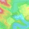
Carte topographique Kathua
Cliquez sur la carte pour afficher l’altitude.
Kathua
Kathua is located at 32°22′N 75°31′E / 32.37°N 75.52°E / 32.37; 75.52. It has an average elevation of 393 metres (1,289 ft). The city is surrounded by three rivers. Ravi is 7 km (4.3 mi) down Kathua while Ujjh is about 11 km (6.8 mi) ahead on Jammu Highway. Kathua itself is situated along the banks of a khad which has been heavily polluted and encroached over there years and this has become a drain of sewage, dividing it into two boroughs: Parliwand, meaning the other side; and Orliwand, meaning this side. Itself being a Plain the area is surrounded in the North by snow-capped Sivalik hills. The large Ranjit Sagar Lake is 25 kms away and has a cooling effect on its climate. Kathua lies 88 kilometres south of Jammu.
À propos de cette carte

Nom : Carte topographique Kathua, altitude, relief.
Lieu : Kathua, Jammu and Kashmir, 184101, India (32.21655 75.36430 32.53655 75.68430)
Altitude moyenne : 411 m
Altitude minimum : 259 m
Altitude maximum : 1 248 m
Autres cartes topographiques
Cliquez sur une carte pour visualiser sa topographie, son altitude et son relief.