
Carte topographique Redmond West Wetlands
Carte interactive
Cliquez sur la carte pour afficher l’altitude.
À propos de cette carte
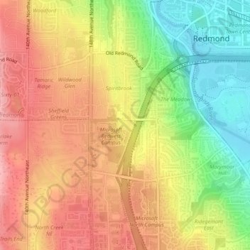
Nom : Carte topographique Redmond West Wetlands, altitude, relief.
Altitude moyenne : 79 m
Altitude minimum : 6 m
Altitude maximum : 137 m
Autres cartes topographiques
Cliquez sur une carte pour visualiser sa topographie, son altitude et son relief.
Earlmont
United States > Washington > King County > Redmond
Earlmont, Redmond, King County, Washington, 98952, United States
Altitude moyenne : 53 m
Marymoor Park
United States > Washington > King County > Redmond
Marymoor Park, Redmond, King County, Washington, United States
Altitude moyenne : 23 m