
Carte topographique Aire Valley Marina
Carte interactive
Cliquez sur la carte pour afficher l’altitude.
À propos de cette carte
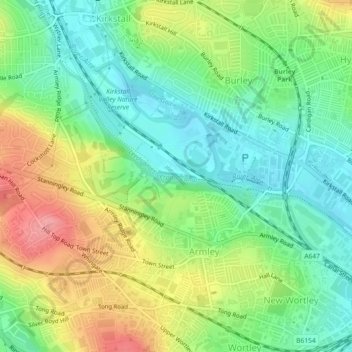
Nom : Carte topographique Aire Valley Marina, altitude, relief.
Altitude moyenne : 66 m
Altitude minimum : 29 m
Altitude maximum : 123 m
Autres cartes topographiques
Cliquez sur une carte pour visualiser sa topographie, son altitude et son relief.
Bramham Park
United Kingdom > England > West Yorkshire > Leeds > Bramham cum Oglethorpe
Bramham Park, Bramham cum Oglethorpe, Leeds, West Yorkshire, England, United Kingdom
Altitude moyenne : 75 m
Scholes
United Kingdom > England > West Yorkshire > Leeds > Scholes
Scholes, Leeds, West Yorkshire, Yorkshire and the Humber, England, LS15 4FD, United Kingdom
Altitude moyenne : 96 m