

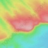
Carte topographique Satlapur
Cliquez sur la carte pour afficher l’altitude.
À propos de cette carte

Nom : Carte topographique Satlapur, altitude, relief.
Lieu : Satlapur, Goharganj Tahsil, Raisen, Madhya Pradesh, India (23.08466 77.51895 23.12058 77.55786)
Altitude moyenne : 452 m
Altitude minimum : 433 m
Altitude maximum : 489 m
Autres cartes topographiques
Cliquez sur une carte pour visualiser sa topographie, son altitude et son relief.
Vindhya Range
India > Madhya Pradesh > Goharganj Tahsil
Technically, the Vindhyas do not form a single mountain range in the geological sense. The exact extent of the Vindhyas is loosely defined, and historically, the term covered a number of distinct hill systems in central India, including the one that is now known as the Satpura Range. Today, the term…
Altitude moyenne : 504 m