
Carte topographique 博美镇
Carte interactive
Cliquez sur la carte pour afficher l’altitude.
À propos de cette carte
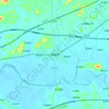
Nom : Carte topographique 博美镇, altitude, relief.
Lieu : 博美镇, 陆丰市, 汕尾市, 广东省, 中国 (22.90889 115.74096 22.98889 115.82096)
Altitude moyenne : 9 m
Altitude minimum : -4 m
Altitude maximum : 80 m
Autres cartes topographiques
Cliquez sur une carte pour visualiser sa topographie, son altitude et son relief.