
Carte topographique Keaton
Carte interactive
Cliquez sur la carte pour afficher l’altitude.
À propos de cette carte
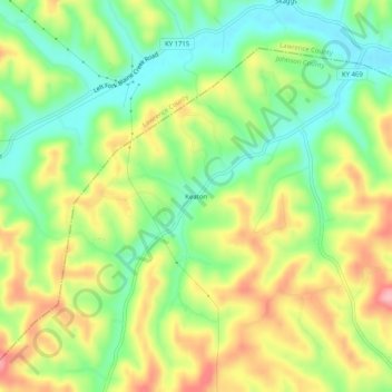
Nom : Carte topographique Keaton, altitude, relief.
Lieu : Keaton, Johnson County, Kentucky, 41226, United States (37.96564 -82.98017 38.00564 -82.94017)
Altitude moyenne : 270 m
Altitude minimum : 205 m
Altitude maximum : 353 m
Autres cartes topographiques
Cliquez sur une carte pour visualiser sa topographie, son altitude et son relief.
Whitehouse
United States > Kentucky > Johnson County
Whitehouse, Johnson County, Kentucky, 41254, United States
Altitude moyenne : 237 m
Paintsville
United States > Kentucky > Johnson County
Paintsville, Johnson County, Kentucky, 41240, United States
Altitude moyenne : 243 m
Dawkins
United States > Kentucky > Johnson County
Dawkins, Johnson County, Kentucky, 41268, United States
Altitude moyenne : 238 m