
Carte topographique Awārān District
Carte interactive
Cliquez sur la carte pour afficher l’altitude.
À propos de cette carte
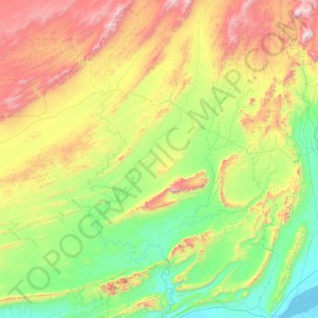
Nom : Carte topographique Awārān District, altitude, relief.
Lieu : Awārān District, Balochistan, Pakistan (25.46667 64.80000 26.86667 66.20000)
Altitude moyenne : 518 m
Altitude minimum : -2 m
Altitude maximum : 1 831 m
Autres cartes topographiques
Cliquez sur une carte pour visualiser sa topographie, son altitude et son relief.
Jhal Jhao
Pakistan > Balochistan > Awaran District > Jhal Jhao
Jhal Jhao, Awaran District, Balochistan, Pakistan
Altitude moyenne : 352 m
Wadi
Pakistan > Balochistan > Awaran District
Wadi, Awaran District, Balochistan, Pakistan
Altitude moyenne : 647 m