
Carte topographique Arlington
Carte interactive
Cliquez sur la carte pour afficher l’altitude.
Arlington
Arlington lies in the Valley of Vermont between the Taconic Range to the west and the Green Mountains to the east, with most of Arlington's land mass lying in the Taconic Range. Five prominent peaks are located within the town: Grass Mountain, Spruce Peak, The Ball (also locally referred to as West Mountain), Red Mountain, and Big Spruce Mountain. The highest peak is Grass Mountain at elevation 3,109 ft (948 m).
À propos de cette carte
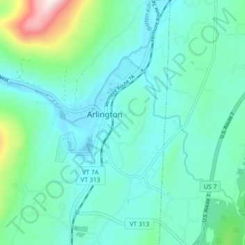
Nom : Carte topographique Arlington, altitude, relief.
Lieu : Arlington, Bennington County, Vermont, United States (43.04866 -73.16635 43.09792 -73.11899)
Altitude moyenne : 282 m
Altitude minimum : 175 m
Altitude maximum : 768 m
Autres cartes topographiques
Cliquez sur une carte pour visualiser sa topographie, son altitude et son relief.