
Faire un don
Équipez-vous pour votre prochaine aventure :
En tant que Partenaire Amazon, ce site perçoit une commission sur les achats éligibles sans surcoût pour vous.
Carte topographique Swaton Wood
Cliquez sur la carte pour afficher l’altitude.
Faire un don
Équipez-vous pour votre prochaine aventure :
En tant que Partenaire Amazon, ce site perçoit une commission sur les achats éligibles sans surcoût pour vous.
À propos de cette carte
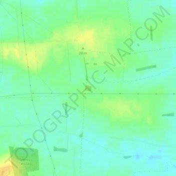
Nom : Carte topographique Swaton Wood, altitude, relief.
Altitude moyenne : 14 m
Altitude minimum : 4 m
Altitude maximum : 27 m
Faire un don
Équipez-vous pour votre prochaine aventure :
En tant que Partenaire Amazon, ce site perçoit une commission sur les achats éligibles sans surcoût pour vous.
Autres cartes topographiques
Cliquez sur une carte pour visualiser sa topographie, son altitude et son relief.
Faire un don
Équipez-vous pour votre prochaine aventure :
En tant que Partenaire Amazon, ce site perçoit une commission sur les achats éligibles sans surcoût pour vous.
Washingborough
United Kingdom > England > Lincolnshire > North Kesteven > Washingborough
Altitude moyenne : 20 m
Faire un don
Équipez-vous pour votre prochaine aventure :
En tant que Partenaire Amazon, ce site perçoit une commission sur les achats éligibles sans surcoût pour vous.
Carlton-le-Moorland
United Kingdom > England > Lincolnshire > North Kesteven > Carlton le Moorland
Altitude moyenne : 13 m
Faire un don
Équipez-vous pour votre prochaine aventure :
En tant que Partenaire Amazon, ce site perçoit une commission sur les achats éligibles sans surcoût pour vous.
Sleaford
United Kingdom > England > Lincolnshire > North Kesteven > Quarrington
Although hardly damaged in the First and Second World Wars, Sleaford has close links with the Royal Air Force due to proximity to several RAF bases, including RAF Cranwell and RAF Waddington. Lincolnshire's topography – flat and open countryside – and its location in the east of the country made it ideal…
Altitude moyenne : 18 m
Faire un don
Équipez-vous pour votre prochaine aventure :
En tant que Partenaire Amazon, ce site perçoit une commission sur les achats éligibles sans surcoût pour vous.
Faire un don
Équipez-vous pour votre prochaine aventure :
En tant que Partenaire Amazon, ce site perçoit une commission sur les achats éligibles sans surcoût pour vous.
Faire un don
Équipez-vous pour votre prochaine aventure :
En tant que Partenaire Amazon, ce site perçoit une commission sur les achats éligibles sans surcoût pour vous.
Faire un don
Équipez-vous pour votre prochaine aventure :
En tant que Partenaire Amazon, ce site perçoit une commission sur les achats éligibles sans surcoût pour vous.
Quarrington
United Kingdom > England > Lincolnshire > North Kesteven
According to the Köppen classification, the British Isles experience a maritime climate characterised by relatively cool summers and mild winters. Lincolnshire's position on the east of the Isles allows for a sunnier and warmer climate relative to the national average, and it is one of the driest counties in…
Altitude moyenne : 21 m
Faire un don
Équipez-vous pour votre prochaine aventure :
En tant que Partenaire Amazon, ce site perçoit une commission sur les achats éligibles sans surcoût pour vous.
Leadenham
United Kingdom > England > Lincolnshire > North Kesteven > Leadenham
Altitude moyenne : 36 m
Faire un don
Équipez-vous pour votre prochaine aventure :
En tant que Partenaire Amazon, ce site perçoit une commission sur les achats éligibles sans surcoût pour vous.
Osbournby
United Kingdom > England > Lincolnshire > North Kesteven > Osbournby
Altitude moyenne : 23 m
Thorpe on the Hill
United Kingdom > England > Lincolnshire > North Kesteven > Thorpe on the Hill
Altitude moyenne : 17 m
Faire un don
Équipez-vous pour votre prochaine aventure :
En tant que Partenaire Amazon, ce site perçoit une commission sur les achats éligibles sans surcoût pour vous.
Billinghay
United Kingdom > England > Lincolnshire > North Kesteven
The settlement is mentioned in the Domesday Book. The name originates from a Saxon name for a fishery. The topography in ancient times would have been that of a small settlement on a gravel mound surrounded by marsh which was flooded in winter. After the draining of the fens in the late 18th century the area…
Altitude moyenne : 4 m
North Scarle
United Kingdom > England > Lincolnshire > North Kesteven > North Scarle
Altitude moyenne : 10 m
Faire un don
Équipez-vous pour votre prochaine aventure :
En tant que Partenaire Amazon, ce site perçoit une commission sur les achats éligibles sans surcoût pour vous.
South Rauceby
United Kingdom > England > Lincolnshire > North Kesteven > South Rauceby
Altitude moyenne : 47 m
Silk Willoughby
United Kingdom > England > Lincolnshire > North Kesteven > Silk Willoughby
Altitude moyenne : 22 m
Faire un don
Équipez-vous pour votre prochaine aventure :
En tant que Partenaire Amazon, ce site perçoit une commission sur les achats éligibles sans surcoût pour vous.
South Kyme
United Kingdom > England > Lincolnshire > North Kesteven > South Kyme
Altitude moyenne : 3 m
Threekingham
United Kingdom > England > Lincolnshire > North Kesteven > Threekingham
Altitude moyenne : 22 m
Faire un don
Équipez-vous pour votre prochaine aventure :
En tant que Partenaire Amazon, ce site perçoit une commission sur les achats éligibles sans surcoût pour vous.
Kirkby la Thorpe
United Kingdom > England > Lincolnshire > North Kesteven > Kirkby la Thorpe
Altitude moyenne : 12 m
Washingborough
United Kingdom > England > Lincolnshire > North Kesteven > Washingborough
Altitude moyenne : 33 m
North Kyme
United Kingdom > England > Lincolnshire > North Kesteven > North Kyme
Altitude moyenne : 4 m
Faire un don
Équipez-vous pour votre prochaine aventure :
En tant que Partenaire Amazon, ce site perçoit une commission sur les achats éligibles sans surcoût pour vous.
Leasingham
United Kingdom > England > Lincolnshire > North Kesteven > Leasingham
Altitude moyenne : 26 m
Witham St. Hughs
United Kingdom > England > Lincolnshire > North Kesteven > Witham St Hughs
Altitude moyenne : 17 m
Faire un don
Équipez-vous pour votre prochaine aventure :
En tant que Partenaire Amazon, ce site perçoit une commission sur les achats éligibles sans surcoût pour vous.
Beckingham
United Kingdom > England > Lincolnshire > North Kesteven > Beckingham
Altitude moyenne : 16 m
Waddington
United Kingdom > England > Lincolnshire > North Kesteven
During the Ice Age, most of the region surrounding Waddington was covered by ice sheets and this has influenced the topography and nature of the soils. Waddington's cliff-top position means it is 226 ft (69 m) above sea level, giving it commanding views over the River Witham valley.
Altitude moyenne : 47 m
Faire un don
Équipez-vous pour votre prochaine aventure :
En tant que Partenaire Amazon, ce site perçoit une commission sur les achats éligibles sans surcoût pour vous.
Heighington
United Kingdom > England > Lincolnshire > North Kesteven > Heighington
Altitude moyenne : 18 m
Faire un don
Équipez-vous pour votre prochaine aventure :
En tant que Partenaire Amazon, ce site perçoit une commission sur les achats éligibles sans surcoût pour vous.
Faire un don
Équipez-vous pour votre prochaine aventure :
En tant que Partenaire Amazon, ce site perçoit une commission sur les achats éligibles sans surcoût pour vous.
Faire un don
Équipez-vous pour votre prochaine aventure :
En tant que Partenaire Amazon, ce site perçoit une commission sur les achats éligibles sans surcoût pour vous.
Helpringham
United Kingdom > England > Lincolnshire > North Kesteven > Helpringham
Altitude moyenne : 8 m
Doddington
United Kingdom > England > Lincolnshire > North Kesteven > Doddington
Altitude moyenne : 19 m
Faire un don
Équipez-vous pour votre prochaine aventure :
En tant que Partenaire Amazon, ce site perçoit une commission sur les achats éligibles sans surcoût pour vous.
Sleaford
United Kingdom > England > Lincolnshire > North Kesteven > Quarrington
The town centre lies about 49 feet (15 m) above sea level and has formed around the River Slea, which runs west to north-east through it. A band of Jurassic Cornbrash limestone forms the bedrock under Holdingham (where the ground rises to 82 feet (25 m) above sea level in places), parts of central Sleaford,…
Altitude moyenne : 18 m
Faire un don
Équipez-vous pour votre prochaine aventure :
En tant que Partenaire Amazon, ce site perçoit une commission sur les achats éligibles sans surcoût pour vous.
Three Kings Deer
United Kingdom > England > Lincolnshire > North Kesteven > Threekingham
Altitude moyenne : 24 m
Faire un don
Équipez-vous pour votre prochaine aventure :
En tant que Partenaire Amazon, ce site perçoit une commission sur les achats éligibles sans surcoût pour vous.
Scredington
United Kingdom > England > Lincolnshire > North Kesteven > Scredington
Altitude moyenne : 13 m
Scredington
United Kingdom > England > Lincolnshire > North Kesteven > Scredington
Altitude moyenne : 13 m
Thorpe on the Hill
United Kingdom > England > Lincolnshire > North Kesteven > Thorpe on the Hill
Altitude moyenne : 17 m
Faire un don
Équipez-vous pour votre prochaine aventure :
En tant que Partenaire Amazon, ce site perçoit une commission sur les achats éligibles sans surcoût pour vous.