
Carte topographique Edson
Carte interactive
Cliquez sur la carte pour afficher l’altitude.
Edson
Due to Edson's high elevation, the community experiences a subarctic climate (Köppen climate classification Dfc). The highest temperature ever recorded in Edson was 37.2 °C (99 °F) on 2 July 1924. The coldest temperature ever recorded was −48.3 °C (−55 °F) on 22 January 1943, and 14 January 1950.
À propos de cette carte
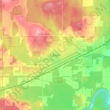
Nom : Carte topographique Edson, altitude, relief.
Lieu : Edson, Town of Edson, Alberta, T7E 1H7, Canada (53.54587 -116.48285 53.62587 -116.40285)
Altitude moyenne : 928 m
Altitude minimum : 868 m
Altitude maximum : 988 m