Géolocaliser

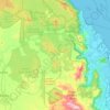
Cartes topographiques Kuranda

Cliquez sur une carte pour visualiser sa topographie, son altitude et son relief.

Kowrowa

Australia > Queensland > Kuranda

Altitude moyenne : 377 m

Barron River

Australia > Queensland > Kuranda

The Barron's headwaters start in the Mount Hypipamee National Park near Mount Hypipamee at an elevation of 1,200 metres (3,900 ft). The river then flows north 65 kilometres (40 mi) across the Atherton Tablelands before finally turning east after Mareeba towards Kuranda. After passing under the Kuranda Range…

Altitude moyenne : 360 m

Équipez-vous pour votre prochaine aventure :

🧥Vestes softshell - Vestes respirantes coupe-vent
🕯️Lanterne de Camp - Éclairage d'ambiance à 360 degrés pour la tente.
🧢Chapeaux de randonnée - Protection solaire pour marche et trekking
🛏️Matelas de camping - Confort de couchage en extérieur
🧼Savons biodégradables - Hygiène respectueuse de l’environnement

En tant que Partenaire Amazon, ce site perçoit une commission sur les achats éligibles sans surcoût pour vous.