Géolocaliser

Cartes topographiques Chorley

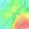
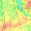
Cliquez sur une carte pour visualiser sa topographie, son altitude et son relief.
Coppull

United Kingdom > England > Lancashire > Chorley

The settlement has an Anglo Saxon name describing its topography derived from the Old English copp a hill top and hyll a hill. The township was variously recorded as Cophull and Cophulle in 1277, Copphull in 1351, Copthull in 1374 and Coppull from 1444.

Altitude moyenne : 79 m

Euxton

United Kingdom > England > Lancashire > Chorley

Altitude moyenne : 50 m

Brinscall

United Kingdom > England > Lancashire > Chorley

Altitude moyenne : 195 m

Équipez-vous pour votre prochaine aventure :

🧤Sous-Gants en Soie - Apport de chaleur supplémentaire ultra-léger.
👕T-shirt Laine Mérinos - Régulation thermique naturelle et anti-odeurs.
☀️Crème Solaire Sport - Haute protection qui résiste à la transpiration.
🧢Bonnets en laine - Protection thermique naturelle
🧥Vestes softshell - Vestes respirantes coupe-vent

En tant que Partenaire Amazon, ce site perçoit une commission sur les achats éligibles sans surcoût pour vous.