

Cartes topographiques Spain
Cliquez sur une carte pour visualiser sa topographie, son altitude et son relief.


Montoro
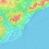
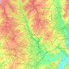
The altitude varies between 782 meters on Cerro de Brezorrubios, in the mountain area, and 143 meters on the banks of the Guadalquivir River. The countryside, south of the river, reaches 335 meters The town is located on a hill, 195 meters above sea level.
Altitude moyenne : 395 m

Sabiñánigo
Spain > Aragon > Alto Gállego
Sabiñánigo (Samianigo in Aragonese) is a municipality located in the province of Huesca, Aragón, Spain, capital of the comarca of Alto Gállego. Formerly, the region was called Serrablo, hence the demonym "serrablese". Sabiñánigo is at an altitude of 780 m and lies 52 km from Huesca.
Altitude moyenne : 1 211 m

Bilbao
Spain > Basque Country > Bilbao
Bilbao is situated in the north-central part of Spain, some 16 kilometres (10 mi) south of the Bay of Biscay, where the economic social development is located, where the estuary of Bilbao is formed. Its main urban core is surrounded by two small mountain ranges with an average elevation of 400 metres (1,300…
Altitude moyenne : 156 m

La Marina
Spain > Valencian Community > el Baix Segura / La Vega Baja > Guardamar del Segura
Altitude moyenne : 7 m


Serra d'Aitana
Spain > Valencian Community > la Marina Baixa > Benifato
The most spectacular part of the trail is the Font de Partagás - Pas de la rabossa - Summit of Aitana with a distance of 2 km. It starts at 1040 meters elevation, with almost 500 meters of uneven terrain. The path is well signposted with trail markings and distance signs.
Altitude moyenne : 836 m

Vigo
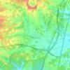
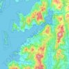
Vigo has a transitional climate between the oceanic climate "Cfb" and the warm-summer Mediterranean climate "Csb" according to the Köppen climate classification. Although Vigo is the rainiest city in Galicia, with its noticeable drying trend in the summer, Vigo's climate is more similar to the variant of the…
Altitude moyenne : 121 m


Trebujena
Spain > Andalusia > Northwest Coast
As at 1 January 2015 it had 7,072 inhabitants. Its surface area is 70 km² and has a density of 101.27 people / km². It is located at an altitude of 69 meters and 57 kilometers from the provincial capital, Cadiz. The neighboring towns are Jerez de la Frontera and Sanlúcar de Barrameda in the province of…
Altitude moyenne : 12 m




Zaragoza
On 1 January 2019 the population of the city of Zaragoza was 706,904, within its administrative limits on a land area of 1,062.64 square kilometres (410.29 square miles), ranking fifth in Spain. It is the 32nd most populous municipality in the European Union. The population of the metropolitan area was…
Altitude moyenne : 701 m


Cerro de la Florosa
Spain > Andalusia > Comarca de la Costa Granadina > Los Guájares
Altitude moyenne : 922 m




Santiago de Compostela
The cathedral borders the main plaza of the old and well-preserved city. According to medieval legend, the remains of the apostle James were brought to Galicia for burial; in 813, the light of a bright star guided a shepherd who was watching his flock at night to the burial site in Santiago de Compostela. This…
Altitude moyenne : 248 m




Seseña
The municipality spans across a total area of 71.41 km2. To the north, the municipality borders the Madrid region. The northern part of Seseña reaches the highest altitude in the municipality, at around 684 metres above mean sea level, while the southern end close to the Jarama and Tagus rivers lies at around…
Altitude moyenne : 592 m


San Nicolás Viewpoint
Spain > Andalusia > Comarca de la Vega de Granada > Granada
Altitude moyenne : 760 m




Cantabria
Towards the south are higher mountains, the tops of which form the watershed between the drainage basins of the Rivers Ebro, Duero and the rivers that flow into the Bay of Biscay. These peaks generally exceed 1,500 m (4,900 ft) from the Pass of San Glorio in the west to the Pass of Los Tornos in the eastern…
Altitude moyenne : 609 m


Parque Municipal Villafranco del Guadiana
Spain > Extremadura > Badajoz > Villafranco del Guadiana
Altitude moyenne : 185 m


