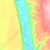
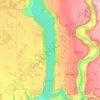
Carte topographique Nourse
Cliquez sur la carte pour afficher l’altitude.
À propos de cette carte

Nom : Carte topographique Nourse, altitude, relief.
Lieu : Nourse, Winnipeg (city), Manitoba, Canada (49.87502 -96.39349 49.89502 -96.37349)
Altitude moyenne : 267 m
Altitude minimum : 263 m
Altitude maximum : 272 m
Autres cartes topographiques
Cliquez sur une carte pour visualiser sa topographie, son altitude et son relief.
Winnipeg
Winnipeg lies at the bottom of the Red River Valley, a flood plain with an extremely flat topography. It is on the eastern edge of the Canadian Prairies in Western Canada and is known as the "Gateway to the West". Winnipeg is bordered by tallgrass prairie to the west and south and the aspen parkland to the…
Altitude moyenne : 236 m


Duck Mountain Provincial Park
Canada > Manitoba > Unorganized Division No. 20 (South)
Altitude moyenne : 656 m


Stonewall
When the last ice age retreated, as well as the prairies, escarpments such as Riding Mountain were left behind. In addition to these, smaller elevations were left behind such as Stony Mountain and Stonewall. It is believed that these escarpments were used as look-outs by early hunters approximately 4,000 to…
Altitude moyenne : 251 m