
Faire un don
Équipez-vous pour votre prochaine aventure :
En tant que Partenaire Amazon, ce site perçoit une commission sur les achats éligibles sans surcoût pour vous.
Carte topographique Behchokǫ̀
Cliquez sur la carte pour afficher l’altitude.
Faire un don
Équipez-vous pour votre prochaine aventure :
En tant que Partenaire Amazon, ce site perçoit une commission sur les achats éligibles sans surcoût pour vous.
Behchokǫ̀
As the community grew alongside increased services such as a mission-run hospital and church, the government viewed the topography of Fort Rae as unsuitable for expansion. In the 1950s there was concern about runoff from animal and human wastes contaminating sources of drinking water, and the government proposed constructing a new settlement on more favourable terrain. The community became known as Edzo and was located on the west side of the Frank Channel opposite Fort Rae a 24 km (15 mi) drive away. Most of the Dene families refused to move from their community so that Rae (62°49′43″N 116°03′08″W / 62.82861°N 116.05222°W / 62.82861; -116.05222 (Rae)) and Edzo (62°46′30″N 116°02′26″W / 62.77500°N 116.04056°W / 62.77500; -116.04056 (Edzo)) (Rae-Edzo) became two separate communities although administered together.
Faire un don
Équipez-vous pour votre prochaine aventure :
En tant que Partenaire Amazon, ce site perçoit une commission sur les achats éligibles sans surcoût pour vous.
À propos de cette carte
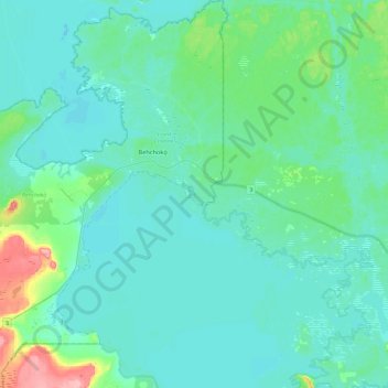
Nom : Carte topographique Behchokǫ̀, altitude, relief.
Altitude moyenne : 169 m
Altitude minimum : 152 m
Altitude maximum : 257 m
Faire un don
Équipez-vous pour votre prochaine aventure :
En tant que Partenaire Amazon, ce site perçoit une commission sur les achats éligibles sans surcoût pour vous.