
Carte topographique Buntzen Lake
Carte interactive
Cliquez sur la carte pour afficher l’altitude.
À propos de cette carte
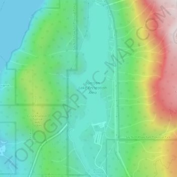
Nom : Carte topographique Buntzen Lake, altitude, relief.
Altitude moyenne : 348 m
Altitude minimum : 0 m
Altitude maximum : 1 158 m
Hiking time: 6–8 hours return. Distance: 15 km (9 mi). Elevation gain: 1,020 m (3,350 ft). This is the most popular of the three Halvor Lunden trails. It passes thought ancient mountain forests and has a number of viewpoints from which overlook Vancouver. The trailhead is on Powerhouse Road, near the southeast corner of the South Beach parking area, and takes you up a steep climb of over 700m, passing the Polytrichum Lookout before reaching the "Lake district" which includes several small lakes and the larger Lindsay Lake.
Autres cartes topographiques
Cliquez sur une carte pour visualiser sa topographie, son altitude et son relief.
Burrard Inlet
Canada > British Columbia > Metro Vancouver Regional District > Anmore
Burrard Inlet, Anmore, District of North Vancouver, Metro Vancouver Regional District, British Columbia, Canada
Altitude moyenne : 478 m