
Carte topographique Two Hills
Carte interactive
Cliquez sur la carte pour afficher l’altitude.
À propos de cette carte
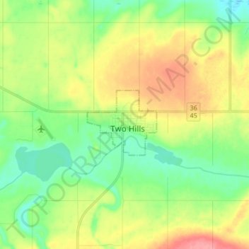
Nom : Carte topographique Two Hills, altitude, relief.
Lieu : Two Hills, Town of Two Hills, Alberta, T0B 4K0, Canada (53.67132 -111.78512 53.75132 -111.70512)
Altitude moyenne : 620 m
Altitude minimum : 588 m
Altitude maximum : 668 m