
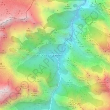
Carte topographique Caín de Valdeon
Carte interactive
Cliquez sur la carte pour afficher l’altitude.
À propos de cette carte
Nom : Carte topographique Caín de Valdeon, altitude, relief.
Altitude moyenne : 1 088 m
Altitude minimum : 416 m
Altitude maximum : 2 017 m
Autres cartes topographiques
Cliquez sur une carte pour visualiser sa topographie, son altitude et son relief.
Mata el Pendín
Spain > Castile and León > Posada de Valdeón
Mata el Pendín, Posada de Valdeón, Riaño, Castile and León, Spain
Altitude moyenne : 933 m