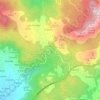
Carte topographique Pazos
Cliquez sur la carte pour afficher l’altitude.
À propos de cette carte

Nom : Carte topographique Pazos, altitude, relief.
Altitude moyenne : 276 m
Altitude minimum : 106 m
Altitude maximum : 526 m
Autres cartes topographiques
Cliquez sur une carte pour visualiser sa topographie, son altitude et son relief.
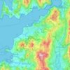
Vigo
Vigo has a warm-summer Mediterranean climate (Köppen: Csb, Trewartha: Csbk), characterized by mild temperatures throughout the year, heavier rainfall on winters and appreciable summer drought. Although Vigo is the rainiest city in Galicia, its pronounced summer drying trend makes its climate more similar to…
Altitude moyenne : 121 m
Vigo
Vigo has a transitional climate between the oceanic climate "Cfb" and the warm-summer Mediterranean climate "Csb" according to the Köppen climate classification. Although Vigo is the rainiest city in Galicia, with its noticeable drying trend in the summer, Vigo's climate is more similar to the variant of the…
Altitude moyenne : 137 m
Vigo
Vigo has a transitional climate between the oceanic climate "Cfb" and the warm-summer Mediterranean climate "Csb" according to the Köppen climate classification. Although Vigo is the rainiest city in Galicia, with its noticeable drying trend in the summer, Vigo's climate is more similar to the variant of the…
Altitude moyenne : 137 m
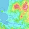
Vigo
Vigo has a transitional climate between the oceanic climate "Cfb" and the warm-summer Mediterranean climate "Csb" according to the Köppen climate classification. Although Vigo is the rainiest city in Galicia, with its noticeable drying trend in the summer, Vigo's climate is more similar to the variant of the…
Altitude moyenne : 124 m
Vigo
Vigo has a transitional climate between the oceanic climate "Cfb" and the warm-summer Mediterranean climate "Csb" according to the Köppen climate classification. Although Vigo is the rainiest city in Galicia, with its noticeable drying trend in the summer, Vigo's climate is more similar to the variant of the…
Altitude moyenne : 124 m
Vigo
Vigo has a transitional climate between the oceanic climate "Cfb" and the warm-summer Mediterranean climate "Csb" according to the Köppen climate classification. Although Vigo is the rainiest city in Galicia, with its noticeable drying trend in the summer, Vigo's climate is more similar to the variant of the…
Altitude moyenne : 137 m