
Carte topographique 上清镇
Carte interactive
Cliquez sur la carte pour afficher l’altitude.
À propos de cette carte
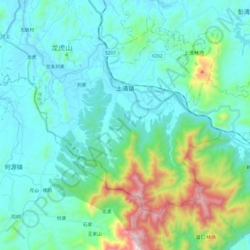
Nom : Carte topographique 上清镇, altitude, relief.
Lieu : 上清镇, 龙虎山区, 贵溪市, 鹰潭市, 江西省, 中国 (27.96410 116.96763 28.07988 117.15091)
Altitude moyenne : 260 m
Altitude minimum : 57 m
Altitude maximum : 1 171 m
Autres cartes topographiques
Cliquez sur une carte pour visualiser sa topographie, son altitude et son relief.