
Carte topographique Slaithwaite
Cliquez sur la carte pour afficher l’altitude.
Slaithwaite
In the 1848 edition of 'A Topographical Dictionary of England', Samuel Lewis (the editor) wrote:- "the lands are in meadow and pasture, with a small portion of arable; the scenery is bold and romantic. In the quarries of the district are found vegetable fossils, especially firs and other mountain trees. The village is beautifully seated in the valley of the river Colne; the inhabitants are chiefly employed in the woollen manufacture, in the spinning of cotton and silk, and in silk-weaving"
À propos de cette carte
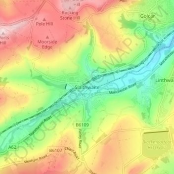
Nom : Carte topographique Slaithwaite, altitude, relief.
Altitude moyenne : 241 m
Altitude minimum : 107 m
Altitude maximum : 391 m
Autres cartes topographiques
Cliquez sur une carte pour visualiser sa topographie, son altitude et son relief.