

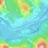
Carte topographique Edson
Cliquez sur la carte pour afficher l’altitude.
Edson
Edson lies in the McLeod River valley, immediately east of the Canadian Rockies foothills. The surrounding landscape consists of primarily taiga forest with sand hills and muskeg. The town is located at an altitude of 925 metres (3,035 ft). Two provincial parks are located west of Edson: Sundance Provincial Park along Sundance Creek and Obed Lake Provincial Park surrounding the three Obed Lakes.
À propos de cette carte

Nom : Carte topographique Edson, altitude, relief.
Lieu : Edson, Alberta, Canada (53.56066 -116.50735 53.59919 -116.37244)
Altitude moyenne : 928 m
Altitude minimum : 869 m
Altitude maximum : 988 m
Autres cartes topographiques
Cliquez sur une carte pour visualiser sa topographie, son altitude et son relief.
Banff
Canada > Alberta > Banff > Banff
Banff is a town within Banff National Park in Alberta, Canada. It is located in Alberta's Rockies along the Trans-Canada Highway, approximately 126 km (78 mi) west of Calgary and 58 km (36 mi) east of Lake Louise. At 1,400 to 1,630 m (4,590 to 5,350 ft) above sea level, Banff is the community with the second…
Altitude moyenne : 1 615 m

Elkwater
Canada > Alberta > Cypress County
The Elkwater townsite lies at an elevation of about 1,225 m (4,025 ft) on the northwest slope of the Cypress Hills which, with a summit at 1,466 m (4810 ft), are the highest point between the Rocky Mountains and Labrador within Canada. Because of the elevation, the area receives more moisture than the…
Altitude moyenne : 1 294 m

Lethbridge
Canada > Alberta > Lethbridge
Its high elevation of 929 m (3,047.9 ft) and close proximity to the Rocky Mountains provides Lethbridge with cooler summers than other locations in the Canadian Prairies. These factors protect the city from strong northwest and southwest winds and contribute to frequent chinook winds during the winter.…
Altitude moyenne : 918 m
Grande Prairie
Canada > Alberta > Grande Prairie
Grande Prairie is located just north of the 55th parallel north, and is 465 km (289 mi) northwest of Edmonton, lying at an elevation of 669 m (2,195 ft) above sea level. The city is surrounded by farmland to the north, east, and west. To the south lies a vast boreal forest with aspen, tamarack, lodgepole pine,…
Altitude moyenne : 668 m


Priddis
Canada > Alberta > Foothills County
Priddis is a hamlet in Alberta, Canada within Foothills County. It is located in the foothills of the Canadian Rockies at an elevation of 1,160 metres (3,810 ft). The hamlet is located southwest of the intersection of the Cowboy Trail (Highway 22) and Highway 22X, approximately 10 kilometres (6.2 mi) west of…
Altitude moyenne : 1 193 m














Beaver Mines Lake
Canada > Alberta > Municipal District of Pincher Creek No. 9
Altitude moyenne : 1 538 m













Nose Hill Park
Names currently associated with topographical features in and near Nose Hill Park reflect the impact of the European newcomers and European trade goods on the Peigan. For example, Spy Hill, the westward extension of Nose Hill, derived its present name from the aboriginal practice of communicating with distant…
Altitude moyenne : 1 174 m

Skeleton Lake
Canada > Alberta > Summer Village of Mewatha Beach > Mewatha Beach
Altitude moyenne : 634 m