
Carte topographique Adlington
Carte interactive
Cliquez sur la carte pour afficher l’altitude.
À propos de cette carte
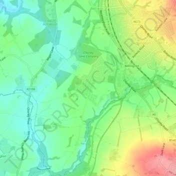
Nom : Carte topographique Adlington, altitude, relief.
Altitude moyenne : 95 m
Altitude minimum : 56 m
Altitude maximum : 162 m
Autres cartes topographiques
Cliquez sur une carte pour visualiser sa topographie, son altitude et son relief.
Euxton
United Kingdom > England > Lancashire > Chorley
Euxton, Chorley, Lancashire, England, United Kingdom
Altitude moyenne : 50 m
Brinscall
United Kingdom > England > Lancashire > Chorley
Brinscall, Chorley, Lancashire, England, PR6 8QS, United Kingdom
Altitude moyenne : 195 m