
Carte topographique 东江乡
Carte interactive
Cliquez sur la carte pour afficher l’altitude.
À propos de cette carte
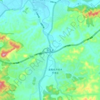
Nom : Carte topographique 东江乡, altitude, relief.
Lieu : 东江乡, 龙南市, 赣州市, 江西省, 中国 (24.82372 114.76501 24.90372 114.84501)
Altitude moyenne : 252 m
Altitude minimum : 200 m
Altitude maximum : 438 m
Autres cartes topographiques
Cliquez sur une carte pour visualiser sa topographie, son altitude et son relief.