
Carte topographique Thorney
Carte interactive
Cliquez sur la carte pour afficher l’altitude.
À propos de cette carte
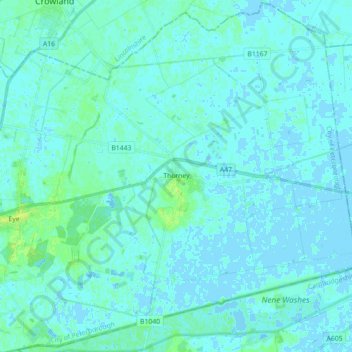
Nom : Carte topographique Thorney, altitude, relief.
Altitude moyenne : 2 m
Altitude minimum : -3 m
Altitude maximum : 11 m
Autres cartes topographiques
Cliquez sur une carte pour visualiser sa topographie, son altitude et son relief.
Peterborough
United Kingdom > England > City of Peterborough
Peterborough, City of Peterborough, Cambridgeshire and Peterborough, England, PE1 1XH, United Kingdom
Altitude moyenne : 17 m
Castor
United Kingdom > England > City of Peterborough
Castor, City of Peterborough, Cambridgeshire and Peterborough, England, United Kingdom
Altitude moyenne : 25 m
Northborough
United Kingdom > England > City of Peterborough
Northborough, City of Peterborough, Cambridgeshire and Peterborough, England, United Kingdom
Altitude moyenne : 8 m