Carte topographique Daroca
Cliquez sur la carte pour afficher l’altitude.
Daroca
The climate in Daroca is cold semi-arid (BSk) bordering on a humid subtropical climate (Cfa) under the Köppen classification. It has an oceanic with hot summer and cool winter (Doak) under the Trewartha classification. This type of climate is common in inland Spain, with low annual rainfall and high summer sunshine. Summers are hot, but tempered by elevation. Winters are mild for the elevation and latitude, although cool by Spanish standards.
À propos de cette carte
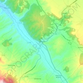
Nom : Carte topographique Daroca, altitude, relief.
Lieu : Daroca, Campo de Daroca, Zaragoza, Aragon, 50360, Spain (41.07142 -1.47460 41.15524 -1.35455)
Altitude moyenne : 866 m
Altitude minimum : 711 m
Altitude maximum : 1 224 m
Autres cartes topographiques
Cliquez sur une carte pour visualiser sa topographie, son altitude et son relief.