
Carte topographique Eday
Cliquez sur la carte pour afficher l’altitude.
À propos de cette carte
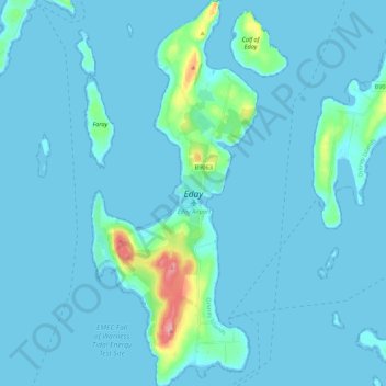
Nom : Carte topographique Eday, altitude, relief.
Lieu : Eday, Orkney Islands, Scotland, United Kingdom (59.13811 -2.82773 59.25045 -2.73360)
Altitude moyenne : 7 m
Altitude minimum : -1 m
Altitude maximum : 100 m
Autres cartes topographiques
Cliquez sur une carte pour visualiser sa topographie, son altitude et son relief.
Ward Hill
United Kingdom > Scotland > Orkney Islands
Ward Hill is a hill on the island of Hoy in Orkney, Scotland. It lies at the north of the island between Moaness and Rackwick, and is the highest point in both Orkney and the Scottish Northern Isles at an elevation of 481 m (1,578 ft).
Altitude moyenne : 194 m