Géolocaliser

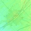
Carte topographique Wheatley

Cliquez sur la carte pour afficher l’altitude.

À propos de cette carte

Nom : Carte topographique Wheatley, altitude, relief.

Lieu : Wheatley, Chatham-Kent, Southwestern Ontario, Ontario, N0P 2P0, Canada (42.05507 -82.50302 42.13507 -82.42302)

Altitude moyenne : 181 m

Altitude minimum : 170 m

Altitude maximum : 193 m

Autres cartes topographiques

Cliquez sur une carte pour visualiser sa topographie, son altitude et son relief.

Bothwell

Canada > Ontario > Chatham-Kent

Altitude moyenne : 207 m

Thamesville

Canada > Ontario > Chatham-Kent

Altitude moyenne : 188 m

Chatham

Canada > Ontario > Chatham-Kent

Altitude moyenne : 182 m

Chatham-Kent—Leamington

Canada > Ontario > Chatham-Kent

Altitude moyenne : 179 m

Blythe Park

Canada > Ontario > Chatham-Kent > Chatham

Altitude moyenne : 182 m

Harwich

Canada > Ontario > Chatham-Kent > Chatham

Altitude moyenne : 189 m

Howard

Canada > Ontario > Chatham-Kent > Morpeth

Altitude moyenne : 198 m

Chatham

Canada > Ontario > Chatham-Kent

In 1790, pioneer surveyor Patrick McNiff departed from Lake St. Clair and travelled upstream along the Thames River to survey the lands that would, in 1792, become Kent County. During this voyage, McNiff found that some 28 families had already established themselves in the region, suggesting the date of the…

Altitude moyenne : 182 m

Chatham

Canada > Ontario > Chatham-Kent

Altitude moyenne : 182 m

Équipez-vous pour votre prochaine aventure :

🧴Gel Hydroalcoolique - Hygiène des mains rapide avant de manger sur le pouce.
⚡Barres Énergétiques - Snacks sains pour un coup de boost lors des montées rudes.
🧥Vestes softshell - Vestes respirantes coupe-vent
📍Traceurs GPS - Suivi et localisation d’équipement
🍼Gourde Isotherme - Garde vos boissons fraîches ou chaudes pendant 24 heures.

En tant que Partenaire Amazon, ce site perçoit une commission sur les achats éligibles sans surcoût pour vous.