
Carte topographique 旭日街道
Carte interactive
Cliquez sur la carte pour afficher l’altitude.
À propos de cette carte
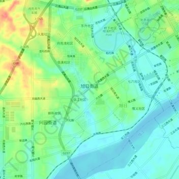
Nom : Carte topographique 旭日街道, altitude, relief.
Lieu : 旭日街道, 广信区, 上饶市, 江西省, 中国 (28.41575 117.89980 28.46083 117.93333)
Altitude moyenne : 83 m
Altitude minimum : 62 m
Altitude maximum : 127 m
Autres cartes topographiques
Cliquez sur une carte pour visualiser sa topographie, son altitude et son relief.