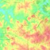
Carte topographique Alpharetta
Cliquez sur la carte pour afficher l’altitude.
À propos de cette carte

Nom : Carte topographique Alpharetta, altitude, relief.
Lieu : Alpharetta, Fulton County, Georgia, United States (34.02815 -84.35944 34.11735 -84.20122)
Altitude moyenne : 324 m
Altitude minimum : 261 m
Altitude maximum : 372 m
Autres cartes topographiques
Cliquez sur une carte pour visualiser sa topographie, son altitude et son relief.

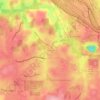

Capital City Country Club Lake Dam
United States > Georgia > Fulton County > Atlanta
Altitude moyenne : 294 m


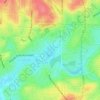
Atlanta
United States > Georgia > Fulton County
Atlanta occupies a high, rolling part of the Georgia Piedmont, a physiographic region described as a landscape of low hills and narrow valleys between the Blue Ridge Mountains and the Upper Coastal Plain. Around downtown and Fulton County, the terrain is gently dissected rather than flat, with broad urban…
Altitude moyenne : 285 m