
Carte topographique Mount Tzouhalem
Carte interactive
Cliquez sur la carte pour afficher l’altitude.
À propos de cette carte
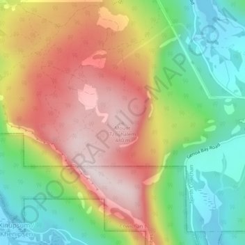
Nom : Carte topographique Mount Tzouhalem, altitude, relief.
Altitude moyenne : 233 m
Altitude minimum : 0 m
Altitude maximum : 492 m
The reserve, at middle elevations (120–280 metres) on the western side of the mountain, faces southwest and has strongly sloping, internally hilly terrain. The Tzuhalem area is a historical harvesting location for the Vancouver Island Coast Salish First Nations. The reserve is a camas harvesting site that was traditionally burned to increase yields and maintain the open, park-like habitat.
Autres cartes topographiques
Cliquez sur une carte pour visualiser sa topographie, son altitude et son relief.
Stoney Hill
Canada > British Columbia > Cowichan Valley Regional District > North Cowichan
Stoney Hill, North Cowichan, Cowichan Valley Regional District, British Columbia, V9L 5T7, Canada
Altitude moyenne : 78 m