Géolocaliser

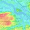
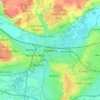
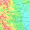
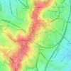
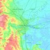
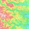
Carte topographique Sandwell

Cliquez sur la carte pour afficher l’altitude.

À propos de cette carte

Nom : Carte topographique Sandwell, altitude, relief.

Lieu : Sandwell, West Midlands, England, United Kingdom (52.46072 -2.09711 52.56907 -1.91816)

Altitude moyenne : 152 m

Altitude minimum : 86 m

Altitude maximum : 270 m

Autres cartes topographiques

Cliquez sur une carte pour visualiser sa topographie, son altitude et son relief.
London

United Kingdom > England > London

Altitude moyenne : 42 m

Erith

United Kingdom > England

Altitude moyenne : 17 m

Leeds

United Kingdom > England

Lying in the eastern foothills of the Pennines, there is a significant variation in elevation within the city's built-up area. The district ranges from 1,115 feet (340 m) in the far west on the slopes of Ilkley Moor to about 33 feet (10 m) where the rivers Aire and Wharfe cross the eastern boundary. Land rises…

Altitude moyenne : 94 m
York

United Kingdom > England > York

Altitude moyenne : 21 m

Burwash Common

United Kingdom > England > East Sussex > Rother

Altitude moyenne : 98 m

Newmarket

United Kingdom > England > Newmarket

Altitude moyenne : 51 m

Bolton

United Kingdom > England > Bolton

Altitude moyenne : 135 m

Derby

United Kingdom > England > Derbyshire

Altitude moyenne : 97 m

Leicester

United Kingdom > England > City of Leicester

Altitude moyenne : 109 m

Salford

United Kingdom > England

At 53°28′59″N 2°17′35″W / 53.48306°N 2.29306°W / 53.48306; -2.29306 (53.483°, −2.2931°), and 205 miles (330 km) northwest of central London, Salford stands about 177 feet (54 m) above sea level, on relatively flat ground to the west of a meander of the River Irwell – the city's main…

Altitude moyenne : 106 m

Shaftesbury

United Kingdom > England > Shaftesbury

Altitude moyenne : 135 m

Chesil Beach

United Kingdom > England > Dorset > Chickerell > Wyke Regis

Altitude moyenne : 13 m

Brownhills

United Kingdom > England

Altitude moyenne : 140 m

Kensington

United Kingdom > England

Altitude moyenne : 19 m

Birkenhead

United Kingdom > England

Altitude moyenne : 24 m

Guisborough

United Kingdom > England > Guisborough

Altitude moyenne : 157 m

Steyning

United Kingdom > England > Steyning

Altitude moyenne : 36 m

Thirsk

United Kingdom > England > Thirsk

Altitude moyenne : 45 m

Hebden Bridge

United Kingdom > England > Calderdale

Altitude moyenne : 277 m

Durham

United Kingdom > England > County Durham

Altitude moyenne : 119 m

Darlington

United Kingdom > England > Darlington

Altitude moyenne : 52 m

Ravenscar

United Kingdom > England > North Yorkshire

Altitude moyenne : 117 m

Tyne and Wear

United Kingdom > England

Altitude moyenne : 144 m

Crewe

United Kingdom > England > Crewe

Altitude moyenne : 53 m

Bedford

United Kingdom > England > Bedford

As with the rest of the United Kingdom, Bedford has a maritime climate, with a limited range of temperatures, and generally even rainfall throughout the year. The nearest Met Office weather station to Bedford is Bedford (Thurleigh) airport, about 6.5 miles (10.5 km) north of Bedford town centre at an elevation…

Altitude moyenne : 37 m

Reading

United Kingdom > England > Reading

Mary Russell Mitford lived in Reading for a number of years and then spent the rest of her life just outside the town at Three Mile Cross and Swallowfield. The fictional Belford Regis of her eponymous novel, first published in 1835, is largely based on Reading. Described with topographical accuracy, it is…

Altitude moyenne : 56 m

Fountainhead

United Kingdom > England > Calderdale

Altitude moyenne : 245 m

Leeming Bar

United Kingdom > England > North Yorkshire

Altitude moyenne : 38 m

Birdwell

United Kingdom > England > Barnsley

Altitude moyenne : 121 m

Stretford

United Kingdom > England > Trafford

Altitude moyenne : 27 m

Pendennis Point

United Kingdom > England > Cornwall > Falmouth

Altitude moyenne : 2 m

Stainburn

United Kingdom > England > Cumberland > Workington

Altitude moyenne : 49 m

Haddenham

United Kingdom > England > Buckinghamshire

Altitude moyenne : 77 m

Yeovilton

United Kingdom > England > Somerset

Altitude moyenne : 20 m

Bodden

United Kingdom > England > Somerset > Doulting

Altitude moyenne : 212 m

Bamford Edge

United Kingdom > England > Derbyshire > High Peak > Bamford

Altitude moyenne : 289 m

Broad Town

United Kingdom > England > Wiltshire

Altitude moyenne : 155 m

Southwell

United Kingdom > England > Dorset

Altitude moyenne : 23 m

Stainland

United Kingdom > England > Calderdale

Altitude moyenne : 193 m

Balsham

United Kingdom > England > Cambridgeshire > Balsham

Altitude moyenne : 97 m

Airedale

United Kingdom > England > East Riding of Yorkshire

Airedale, in conjunction with the Ribble Valley, provides low-altitude passes from Yorkshire to Lancashire through the Aire Gap. It is therefore an important transport route and was a strategically important area historically.

Altitude moyenne : 60 m

Raithby

United Kingdom > England > Lincolnshire > East Lindsey

Altitude moyenne : 54 m

Luton

United Kingdom > England > Borough of Luton

Altitude moyenne : 145 m

Lewisham

United Kingdom > England > Greater London

Altitude moyenne : 28 m

Chiswick

United Kingdom > England > Greater London

Altitude moyenne : 18 m

Streatham

United Kingdom > England

Altitude moyenne : 37 m

Scafell Pike

United Kingdom > England > Cumberland

Scafell Pike (/ˈskɔːfɛl paɪk/) is the highest and the most prominent mountain in England, at an elevation of 978 metres (3,209 ft) above sea level. It is located in the Lake District National Park, in Cumbria, and is part of the Southern Fells and the Scafell massif.

Altitude moyenne : 679 m

Parliament Hill

United Kingdom > England > London

Altitude moyenne : 81 m

Diss

United Kingdom > England > Norfolk

Altitude moyenne : 35 m

Warsash

United Kingdom > England > Hampshire > Fareham

Altitude moyenne : 15 m

Swanage

United Kingdom > England > Swanage

Altitude moyenne : 28 m

Hyde Park

United Kingdom > England > City of Westminster

"It consists of a screen of handsome fluted Ionic columns, with three carriage entrance archways, two-foot entrances, a lodge, etc. The extent of the whole frontage is about 107 ft (33 m). The central entrance has a bold projection: the entablature is supported by four columns; and the volutes of the capitals…

Altitude moyenne : 25 m

Woolacombe

United Kingdom > England > Devon > North Devon

Altitude moyenne : 81 m

Burwell

United Kingdom > England > Burwell

Altitude moyenne : 12 m

Wincanton

United Kingdom > England > Somerset

Altitude moyenne : 102 m

Blackburn

United Kingdom > England > Blackburn with Darwen

Altitude moyenne : 157 m

Top of Hebers

United Kingdom > England > Middleton

Altitude moyenne : 117 m

Steep Hill

United Kingdom > England > Lincolnshire > Lincoln

Altitude moyenne : 32 m

Peterborough

United Kingdom > England > Cambridgeshire

The local topography is flat, and in some places, the land lies below sea level, for example in parts of the Fens to the east and to the south of Peterborough. Human settlement in the area began before the Bronze Age, as can be seen at the Flag Fen archaeological site to the east of the current city centre,…

Altitude moyenne : 17 m

Caldy

United Kingdom > England

Altitude moyenne : 23 m

Rockly Ford

United Kingdom > England > Mendip > Foxcote > Rockly Ford

Altitude moyenne : 129 m

Royston

United Kingdom > England

Royston lies on the Barnsley Canal, and on the intersection of the B6132 and B6428 roads, due north of Monk Bretton at an elevation of around 246 feet (75 m) above sea level. The Trans Pennine Trail runs through Royston along the canal bank. The parish is part of the diocese of Leeds.

Altitude moyenne : 74 m
Brierley Hill

United Kingdom > England

Altitude moyenne : 122 m

Huddersfield

United Kingdom > England > Kirklees

Altitude moyenne : 145 m

Keighley

United Kingdom > England > Keighley

Altitude moyenne : 200 m

Horncastle

United Kingdom > England > East Lindsey > Horncastle

Altitude moyenne : 52 m

Carlisle

United Kingdom > England > Cumberland

Altitude moyenne : 31 m

Cambridge

United Kingdom > England > Cambridge

The city, like most of the UK, has a maritime climate highly influenced by the Gulf Stream. Located in the driest region of Britain, Cambridge's rainfall averages around 570 mm (22.44 in) per year, around half the national average, with some years occasionally falling into the semi-arid (under 500 mm (19.69…

Altitude moyenne : 18 m
Brighton

United Kingdom > England > Brighton and Hove

Altitude moyenne : 64 m

Sharperton

United Kingdom > England > Northumberland

Altitude moyenne : 165 m

Triscombe

United Kingdom > England > Somerset > West Bagborough

Altitude moyenne : 216 m

Stithians Reservoir

United Kingdom > England > Cornwall > Carnkie

Altitude moyenne : 169 m

Fernworthy Reservoir

United Kingdom > England > Devon > West Devon

Altitude moyenne : 381 m

Leith Hill

United Kingdom > England > Surrey > Mole Valley

Altitude moyenne : 196 m

Sarisbury

United Kingdom > England > Hampshire > Fareham

Altitude moyenne : 23 m

Cheadle Hulme

United Kingdom > England

Altitude moyenne : 72 m

Shevington

United Kingdom > England > Wigan

Altitude moyenne : 63 m

Bromley Green

United Kingdom > England > Kent > Ashford > Orlestone

Altitude moyenne : 44 m

Redmire

United Kingdom > England > North Yorkshire

Altitude moyenne : 223 m

Cross Fell

United Kingdom > England > Westmorland and Furness

Cross Fell, Great Dun Fell and Little Dun Fell form a block of high terrain which is all over 800 metres (2,625 ft) in elevation. This is the largest block of high ground in England and tends to retain snow-cover longer than neighbouring areas. Snow can be found in gullies on the north side of Cross Fell as…

Altitude moyenne : 753 m
Stafford

United Kingdom > England > Staffordshire > Stafford > Stafford

Altitude moyenne : 97 m

Bradford

United Kingdom > England

Bradford is located at 53°45′00″N 01°50′00″W / 53.75000°N 1.83333°W / 53.75000; -1.83333 (53.7500, -1.8333)1. Topographically, it is located in the eastern moorland region of the South Pennines.

Altitude moyenne : 167 m

Équipez-vous pour votre prochaine aventure :

🧦Chaussettes de randonnée - Chaussettes techniques anti-ampoules
🎩Bonnet Technique - Protégez vos oreilles du vent sur les crêtes.
📚Guides Randonnée Luxembourg - Découvrez les meilleurs sentiers du Grand-Duché.
🛏️Matelas de camping - Confort de couchage en extérieur
🧴Répulsifs anti-insectes - Protection contre moustiques et tiques

En tant que Partenaire Amazon, ce site perçoit une commission sur les achats éligibles sans surcoût pour vous.