
Faire un don
Équipez-vous pour votre prochaine aventure :
En tant que Partenaire Amazon, ce site perçoit une commission sur les achats éligibles sans surcoût pour vous.
Carte topographique Río
Cliquez sur la carte pour afficher l’altitude.
Faire un don
Équipez-vous pour votre prochaine aventure :
En tant que Partenaire Amazon, ce site perçoit une commission sur les achats éligibles sans surcoût pour vous.
À propos de cette carte
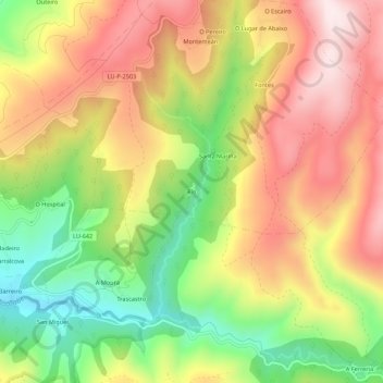
Nom : Carte topographique Río, altitude, relief.
Altitude moyenne : 803 m
Altitude minimum : 527 m
Altitude maximum : 1 060 m
Faire un don
Équipez-vous pour votre prochaine aventure :
En tant que Partenaire Amazon, ce site perçoit une commission sur les achats éligibles sans surcoût pour vous.
Autres cartes topographiques
Cliquez sur une carte pour visualiser sa topographie, son altitude et son relief.
Samos
Samos is near the eastern mountains of Galicia (the mountains of Lóuzara, Serra do Oribio and Mountains of Albola). The mean altitude is over 700 m and the highest elevation is the mountain of O Oribio at 1,443 m. The Sarria River, a tributary of the Miño River, collects water from the western slopes of the…
Altitude moyenne : 742 m
Faire un don
Équipez-vous pour votre prochaine aventure :
En tant que Partenaire Amazon, ce site perçoit une commission sur les achats éligibles sans surcoût pour vous.