
Carte topographique Fencott
Cliquez sur la carte pour afficher l’altitude.
À propos de cette carte
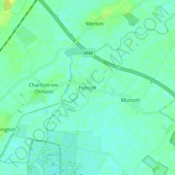
Nom : Carte topographique Fencott, altitude, relief.
Altitude moyenne : 61 m
Altitude minimum : 56 m
Altitude maximum : 71 m
Autres cartes topographiques
Cliquez sur une carte pour visualiser sa topographie, son altitude et son relief.
Weston-on-the-Green
United Kingdom > England > Oxfordshire > Cherwell District
Altitude moyenne : 72 m
Bicester
United Kingdom > England > Oxfordshire > Cherwell District
Bicester has expanded rapidly in recent generations due to the town's picturesque historical town centre, garden town layout, independent and high-street shops, restaurants, as well as a rail connection to Oxford. It also boasts imminent connection to Cambridge, as well as rail links to Birmingham and London.…
Altitude moyenne : 77 m
Roman Meadow Banbury Country Park
United Kingdom > England > Oxfordshire > Cherwell District > Little Bourton
Altitude moyenne : 103 m
Deddington
United Kingdom > England > Oxfordshire > Cherwell District
Clifton, Deddington and Hempton stand on a ridge of Jurassic ferruginous marlstone hills between the three watercourses. Clifton is about 1+1⁄2 miles (2.4 km) east of Deddington, at the eastern end of the ridge where it slopes down to the Cherwell. The ridges rises westward. Deddington is about 430 feet (130…
Altitude moyenne : 107 m
The Lake
United Kingdom > England > Oxfordshire > Cherwell District > Hardwick
Altitude moyenne : 120 m
Begbroke
United Kingdom > England > Oxfordshire > Cherwell District > Begbroke
Altitude moyenne : 75 m
Horton-cum-Studley
United Kingdom > England > Oxfordshire > Cherwell District > Horton-cum-Studley
Altitude moyenne : 71 m
Stoke Lyne
United Kingdom > England > Oxfordshire > Cherwell District > Stoke Lyne
Altitude moyenne : 116 m
Stratton Audley
United Kingdom > England > Oxfordshire > Cherwell District > Stratton Audley
Altitude moyenne : 92 m
South Newington
United Kingdom > England > Oxfordshire > Cherwell District > South Newington
Altitude moyenne : 139 m
Cropredy
United Kingdom > England > Oxfordshire > Cherwell District > Cropredy
Altitude moyenne : 124 m